Skip to content
Email
Login
Menu
Login
No products in the cart.
$
0.00
Cart
Home
|
Art Prints
|
More
The Ibis
Shipping and Returns
Privacy Policy
Contact
Search Products...
×
No products in the cart.
$
0.00
Cart
No products in the cart.
$
0.00
Cart
Home
Prints
More
The Ibis
Shipping and Returns
Privacy Policy
Contact
Menu
Home
Prints
More
The Ibis
Shipping and Returns
Privacy Policy
Contact
Home
Prints
More
The Ibis
Shipping and Returns
Privacy Policy
Contact
Menu
Home
Prints
More
The Ibis
Shipping and Returns
Privacy Policy
Contact
Search Products...
×
Search
Maps
Maps
Italian School : “Fool’s Cap World Map” (c. 1590)
Maps
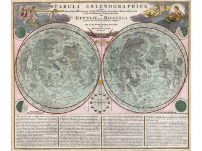
Johann Homann and Johann Gabriel Doppelmayr : “Map of the Moon (Tabula Selenographica)” (1707 or 1742)
Maps
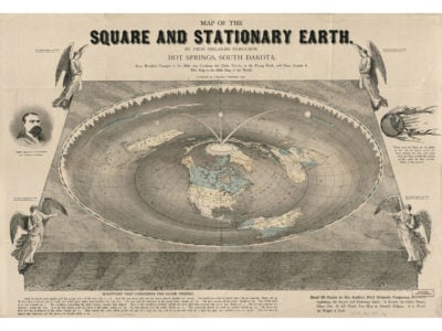
Orlando Ferguson : “Map of the Square and Stationary Earth” (1893)
Maps
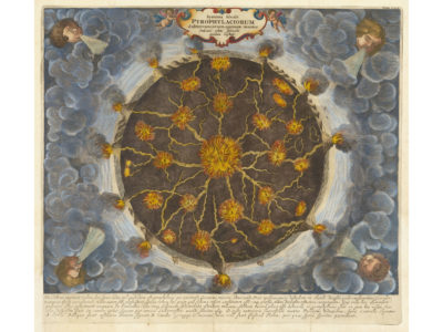
Athanasius Kircher : “Systema Ideale Pyrophylaciorum Suberraneorum” (1665)
Maps
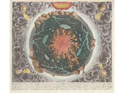
Athanasius Kircher : “Systema Ideale quo Exprimitur, Aquarum” (c. 1668)
Maps
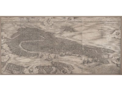
Jacopo de’ Barbari : “View of Venice” (1500)
Maps
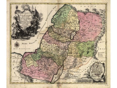
Tobias Lotter : “Map of the Holy Land, or Palestine” (1759)
Maps
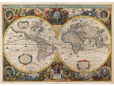
Hendrik Hondius : “New Map of the World” (Atlas Novus, 1641)
Maps
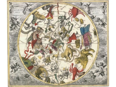
Andreas Cellarius : “The Northern Stellar Hemisphere of Antiquity (Plate 24)” (1708)
Maps
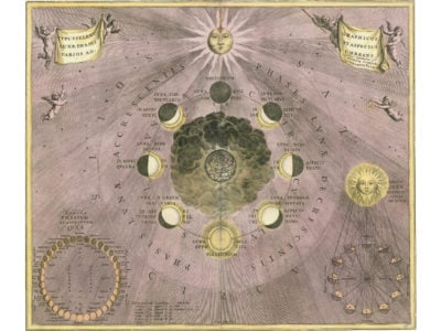
Andreas Cellarius : “Selenographic Diagram Depicting the Varying Phases and Appearances of the Moon by Shading (Plate 19)” (1708)
Maps
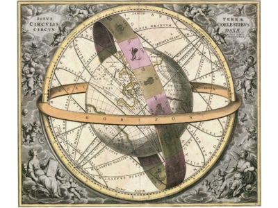
Andreas Cellarius : “Location of the Earth Encircled by the Celestial Circles (Plate 11)” (1708)
Maps
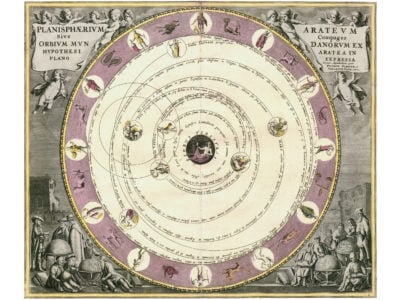
Andreas Cellarius : “The Planisphere of Aratus (Plate 8)” (1708)
Maps
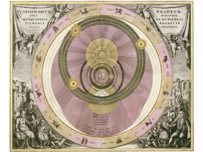
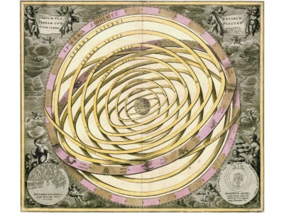
Andreas Cellarius : “The Planisphere of Brahe (Plate 6)” (1708)
Maps
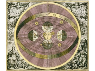
Andreas Cellarius : “Scenography of the Copernican World System (Plate 5)” (1708)
Maps
Andreas Cellarius : “Scenography of the Planetary Orbits Encompassing the Earth (Plate 3)” (1708)
Maps
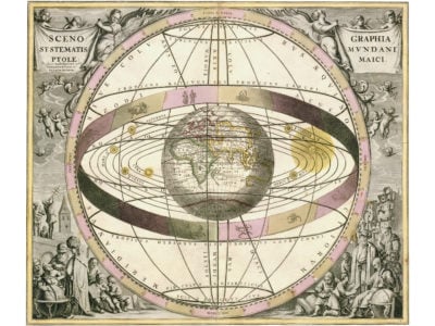
Andreas Cellarius : “Scenography of the Ptolemaic Cosmography (Plate 2)” (1708)
Maps
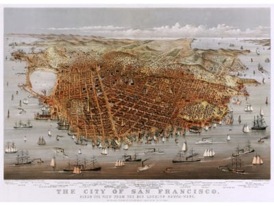
Currier and Ives : “Perspective Map of the City of San Francisco” (1878)
Maps
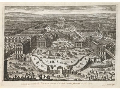
Gabriel Perelle : “A General View of Versailles as Seen in the Present Year 1682” (1682)
Maps
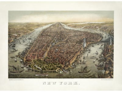
George Schlegel and George Degen : “Perspective Map of New York City” (c. 1873)
Maps
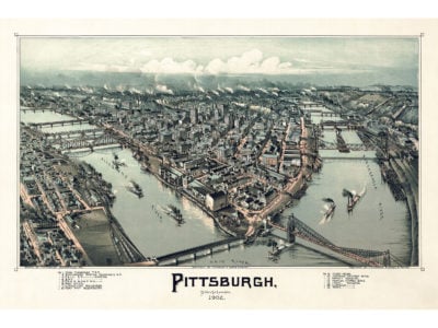
Thaddeus Mortimer Fowler : “Perspective Map of Pittsburgh, Pennsylvania” (1902)
Maps
Piri Reis : “Western Hemisphere within a Wind Rose with the Atlantic Ocean in the Center”
Maps
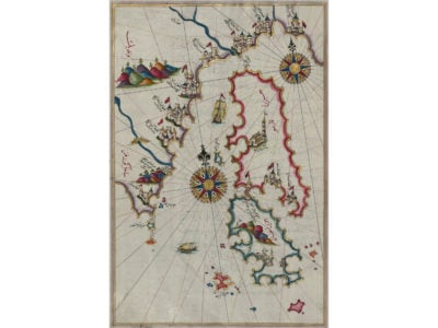
Piri Reis : “Map of the Islands of Cres, Losinj, and Unije”
Maps
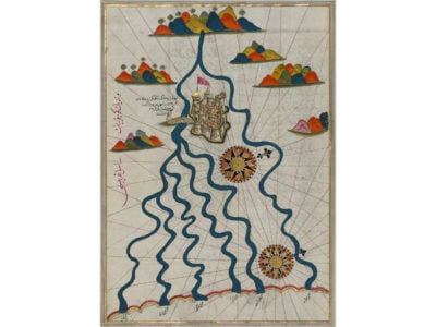
Piri Reis : “Map of the City of Ferrara with the Six Rivers Flowing into the Gulf of Venice”
Maps
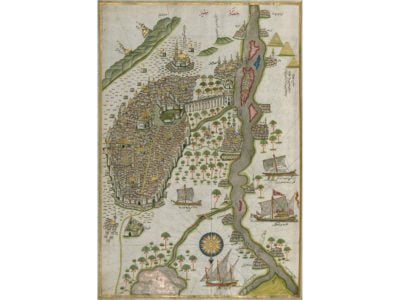
Piri Reis : “Map of the City of Cairo”
Maps
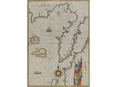
Piri Reis : “Map of the Islands of Semendrek and Imroz in the Aegean Sea”
Maps
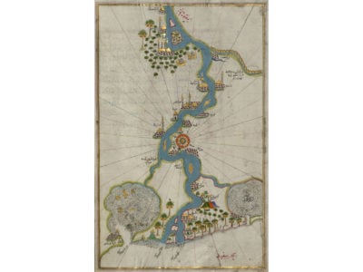
Piri Reis : “Map of the River Nile from Its Estuary South”
Maps
Heinrich Berann : “Panorama of Yosemite National Park” (1989)
Maps
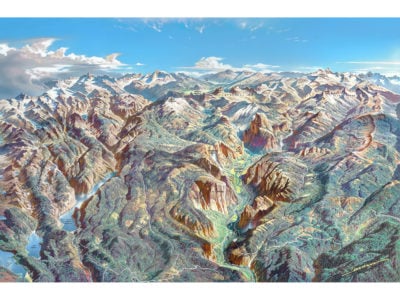
Heinrich Berann : “Panorama of North Cascades National Park” (1987)
Maps
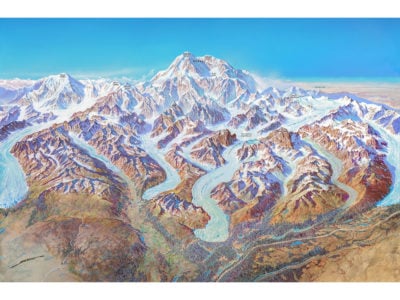
Heinrich Berann : “Panorama of Denali National Park” (1994)
Maps
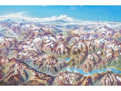
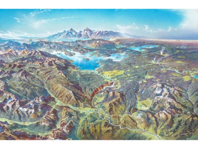
Heinrich Berann : “Panorama of Yellowstone National Park” (1991)
Maps
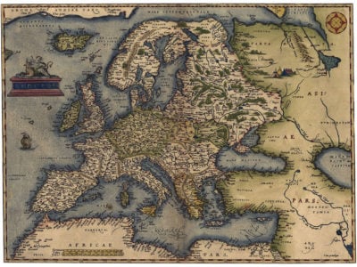
Abraham Ortelius : “Map of Europe” (1570)
Maps
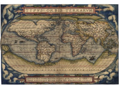
Abraham Ortelius : “Typus Orbis Terrarum (World Map)” (1570)
Maps
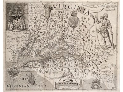
Captain John Smith : “Map of Virginia” (1612)
Maps
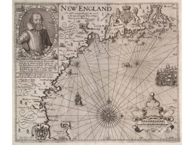
Captain John Smith : “Map of New England” (1616)
Maps
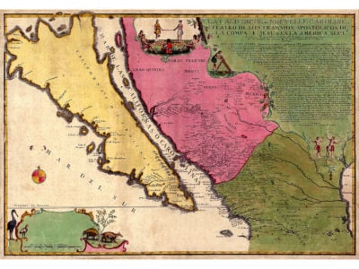
Eusebio Kino and Nicolas de Fer : “Map of the Island of California or New Carolina” (1720)
Maps
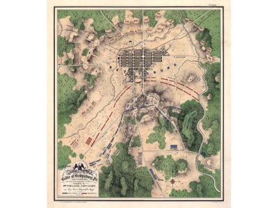
William H. Willcox : “Map of the Battle of Gettysburg, PA” (c. 1863)
1
2
→
Scroll to Top